Navigate on this page:
Chart Types & Purchasing Options
EasyVFR 4 offers georeferenced raster charts from national aviation authorities and commercial suppliers. These charts are available in two purchasing models:
Chart Suppliers
EasyVFR 4 works with various chart suppliers to provide comprehensive coverage across Europe and beyond:
European VFR Chart for Dynon Avionics: Tailor made by the EasyVFR team for Dynon Systems covering all of Europe
Deutsche Flugsicherung (DFS): Charts for many countries
Rogers Data: Full European Coverage
Air Million: Charts for several countries and larger regions
Patrik Sainer: Chart for Czech Republic and Slovakia
ANC Finland from Karttakeskus: Finnish aviation charts
IGN France: French national charts from IGN
CartaBossy France: French charts from CartaBossy
Swisstopo Switserland: Swiss chart from Swisstopo
All valid and available charts are listed in the EasyVFR 4 shop at https://easyvfr4.aero/shop/#charts
One-Time Purchase Charts
Most charts are available with a one-time payment for a specific chart version (as mentioned in the product name). Once purchased, you can download and use these charts on compatible devices as long as they remain valid according to their publication cycle.
Subscription Charts
Some charts like the one from Rogers Data and the European VFR Chart for Dynon Avionics are offered as subscription products, allowing continuous access as long as your subscription remains active. During the subscription period, new chart versions are automatically available for download when published by the chart supplier.
View the Charts on your SkyView
We're assuming you have already successfully filled your Dynon USB memory stick; how that's done is described here.
A SkyView does not have sufficient memory to hold the charts. The memory stick should remain plugged in, or the chart will not be available.
For a two-panel setup, you’re allowed to copy the stick onto a second stick and insert that in your #2 panel. The #2 panel will authenticate with the master panel at system start via the Dynon network cable, and you will be able to use the plates on either panel.
Dynon SkyView HDX
Insert your prepared Dynon USB memory stick into your SkyView panel.
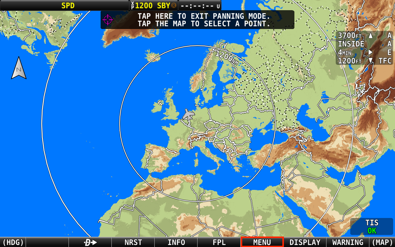
Select [MENU]
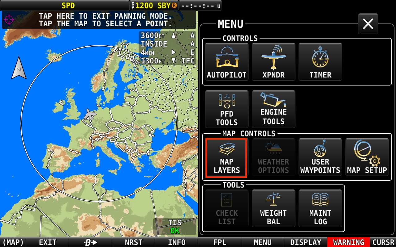
Select [MAP LAYERS].
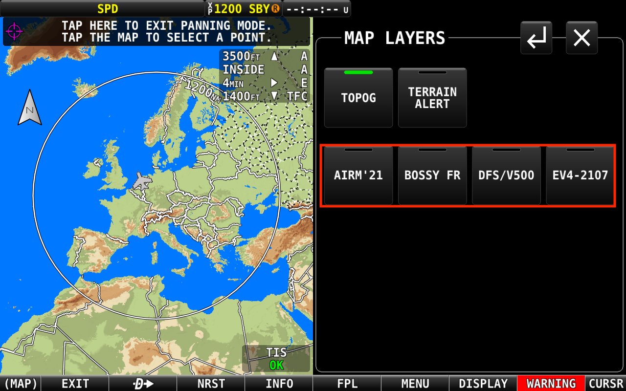
Tap on the chart you want to show on the map.
Note that only the charts that are unlocked in the KeyFile are listed. Always make sure to have the latest KeyFile and chart files downloaded.
Charts purchased before March 2021 (filename starts with an F, H or I), can break the menu structure when combined with the latest charts. Advice is to only have the files of valid charts on your Dynon USB memory stick (filename starts with an J or 0).
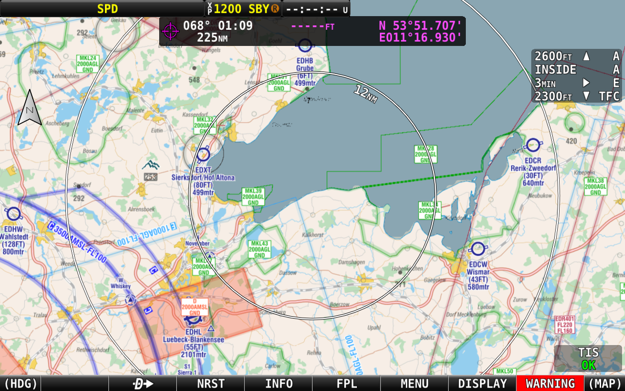
You can zoom and pan the chart on the moving map with pinching on the touchscreen as well as with the right dial.
Dynon SkyView Classic
Viewing the charts works very similar to SkyView HDX. The only difference is that in order to see the [INFO] button at step 2.2 you first need to click on [MAP] > [LAYERS]. See page two of this document: View SkyView charts.
Another obvious difference is the screen quality, some plates and charts shown on SkyView Classic won't be as sharp and readable as they are on an HDX.
Dynon Certified Compatibility
Raster charts are compatible with most Dynon Certified firmware versions. Some certified SkyView versions have dedicated firmware as part of their certification process. Depending on the base version, a chart or dataset may not be compatible with these systems. When in doubt, please contact our team.
Owners and users of SkyViews running aircraft-specific firmware should contact Dynon Support before acquiring a license.
Overlay Aviation Vector Data over Chart
SkyView has a setting that controls whether vector layers are displayed over a raster chart.
When this setting is disabled (the default), SkyView still uses the aviation dataset for map interaction, airfield information, navigation, and warnings. However, airspace lines, obstacles, and navaids are not overlaid on the enabled raster chart to reduce visual clutter.
If you prefer to see these vector elements, you can enable them. The exact steps depend on your SkyView model:
For SkyView HDX:
Go to MENU → MAP SETUP → MAP MODE → "SHOW AVIATION DATA OVER CHART"For SkyView Classic:
Go to MAP → MAP MENU → MAP MODE → "SHOW AVIATION DATA OVER CHART"
Support
If you run into problems while following the procedure, please don’t hesitate to contact us.
Email us at [email protected] or use the blue "Ask the team" contact bubble at the bottom right of this page.
Please verify that you have followed all the steps in this manual, inform us at which step you ran into problems, and share screenshots or a video so we can assist most appropriately.