GRAMET-like WX in the VPV during planning mode
EasyVFR4 can show the clouds and winds at multiple heights, as well as SIGWX along your planned route in the Vertical Profile View (VPV). But that's not all. EasyVFR4 will also take your travel speed into account, so you will see the forecasted WX displayed for the estimated time you will pass any given position - similar to a GRAMET. This can be a big advantage if you will fly multiple hours.
For a better overview, you can see the lower clouds, wind and significant weather directly on the map, travel through time and zoom far out to get a complete picture of the forecasted WX development during your trip.
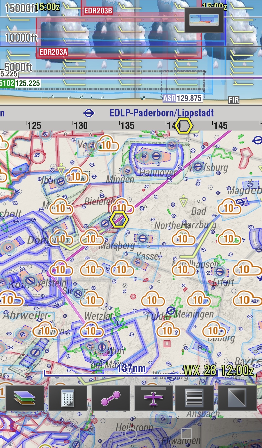
To see the WX at a higher level you need to increase the shown airspaces altitude via the 'Map Layers' menu.
The cloud base and tops of the plotted CBs (the big grey ones) in the VPV represents the forecasted heights.
The smaller cloud(layer)s in the VPV appear at the different altitudes that they are forecasted for.
Cloud coverage (octas) is represented by the spaces between the plotted clouds in the VPV.
The direction of the wind symbols in the VPV represents the tail- and headwind.
See the EV3 manual (for now) for a more detailed explanation of all WX symbols.
The used altitudes for winds aloft and cloud coverage calculations are:
500ft, 1000ft, 1500ft, 2000ft, 3000ft, 4000ft, 5000ft, 6000ft AMSL
FL080, FL1000, FL120, FL140 and FL160
The wind symbols on the map represent the wind at 2000ft AGL.
The latest WX model run will be downloadable every six hours; around 0000, 0600, 1200 and 1800 UTC.
Each model run forecasts for 48 hours in advance, in one-hour intervals.
GRAMET-Like WX in the VPV during flight mode.
Composing the GRAMET data in the VPV is a process that is fairly power-consuming, so when EasyVFR 4 is in flightmode the VPV will not display all the weather related data unless your actual flightpath is within certain margins of your planned flightpath. These margins are settable using menu->system :
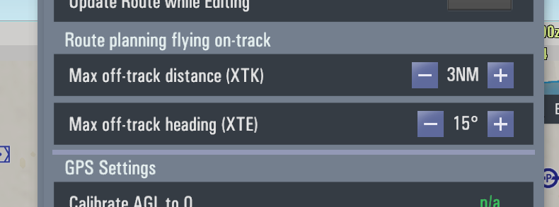
and the default is a maximum of 3NM off track laterally *and* current track within 15 degrees of the planned track.