On this page:
Spot Elevations
Spot elevations are marked by black dots on the map, showing elevation in feet AMSL. They are enabled by default. You can toggle them on or off by going to Map Layers → Other → Geo.
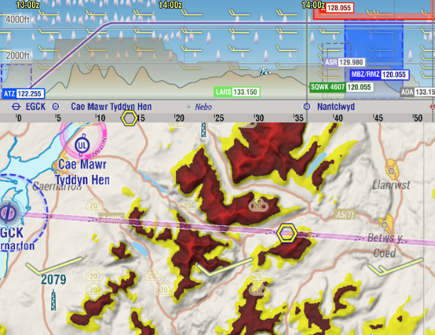
Valley Terrain (When Planning)
When planning your route, you might not need relative terrain. Instead, use the Valley Terrain feature to highlight terrain above a certain altitude. This feature colors terrain above the Valley Reference Elevation from yellow to red, making valleys and high terrain features stand out.
Activate this feature via Map Layers → Terrain → Valley Terrain.
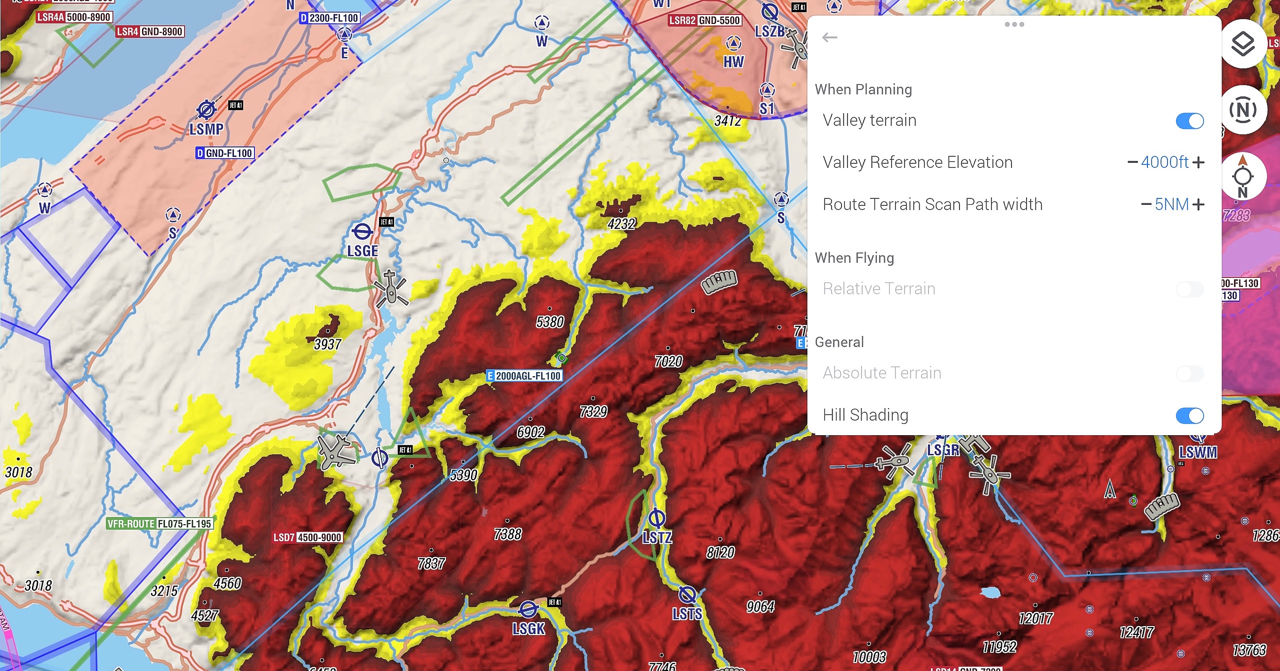
Relative Terrain (When Flying)
Relative Terrain coloring is a safety feature for flying in mountainous areas. It shows terrain relative to your current altitude:
0 to 700 ft below your altitude: Displayed with a gradient from red to yellow, ensuring terrain above you is solid dark red.
Valleys and lower terrain: Easily recognizable due to color contrast.
Enable this feature while flying via Map Layers → Terrain → Relative Terrain.
Absolute Terrain and Hill Shading
These options are enabled by default to enhance terrain visibility:
Absolute Terrain: Uses a color scheme to represent elevations from 0 AMSL to the highest terrain.
Hill Shading: Highlights terrain edges and contours for better visibility.
Absolute Terrain is disabled when Valley Terrain or Relative Terrain is active. Access these settings via Map Layers → Terrain in the General section.
Terrain and Highest Terrain in Vertical Profile
EasyVFR 4 displays not only the terrain elevation right below the track in the Vertical Profile (VP) but also indicates the highest terrain within a 5 nm radius. This feature helps you maintain safe altitudes by considering the highest obstacles around your route.
Proposed Leg Altitude: Automatically adds 1,000 ft above the highest terrain or obstacle found within 5 nm on either side of each leg.
Terrain in Vertical Profile:
The brown-colored terrain below the track represents the ground elevation directly along your planned route.
The translucent terrain behind the brown terrain indicates the highest terrain within the surrounding 5 nm area.
This visualization is effective for both planned routes and current tracks when flying.