Europe's airspace system has become increasingly complex over the years. Many airspaces are defined for combined civilian and military use, where military users can claim such airspace with as little as 24 hours' notice. Increased geopolitical tensions also force authorities to quickly set up prohibited, restricted, and no-fly zones, often outside the standard AIRAC AIP delivery dates.
On this page:
The difference between Static and Dynamic Airspace Mapping
Without Dynamic Airspace Mapping
Traditional paper maps cannot depict the day-to-day or even hour-to-hour dynamic airspace activations. For example, an area in the Netherlands with several defined military airspaces looks like this on the official paper map.
Image: Traditional Mapping
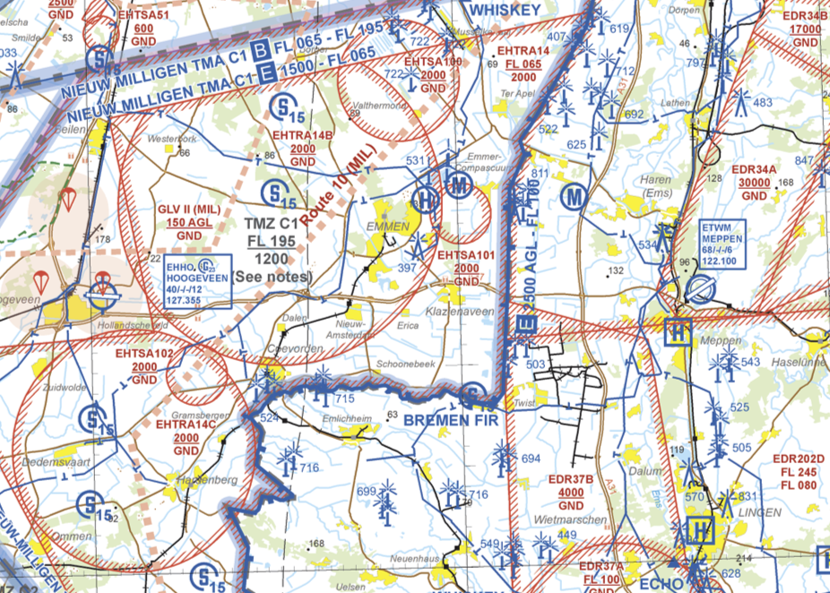
When looking at this map, it's very difficult to tell where a GA pilot is allowed to fly, and the north-eastern part looks like an area to stay away from in all cases.
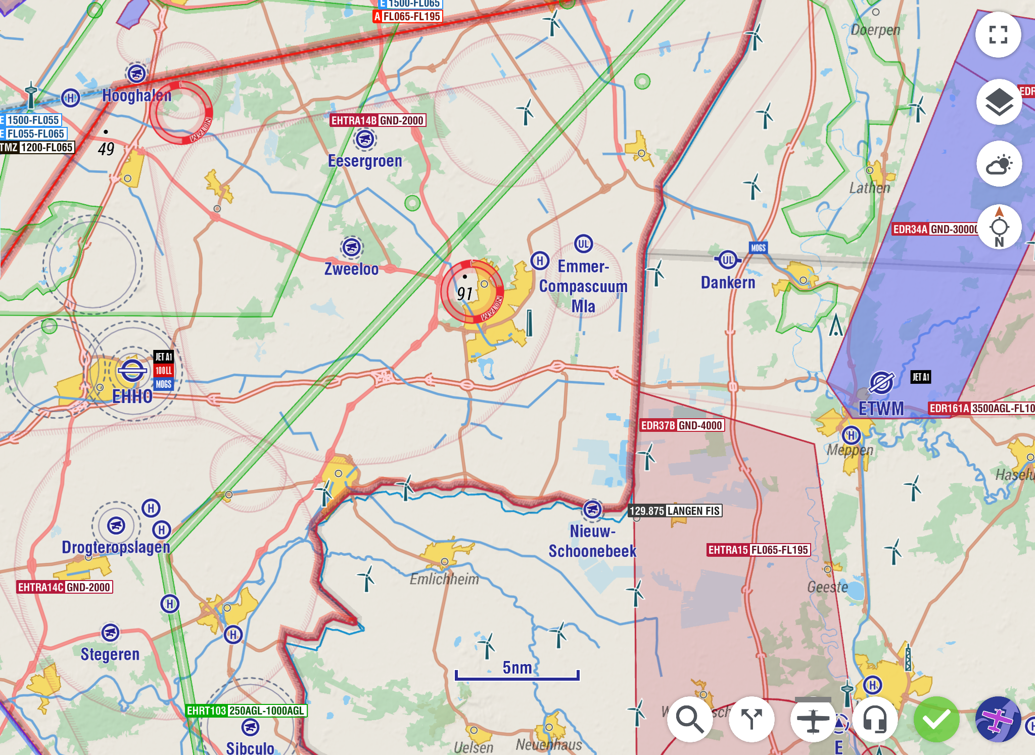
With Dynamic Airspace Mapping
With EasyVFR, thanks to our meticulously maintained airspace database and direct NOTAM and Airspace Use Plan feed, EasyVFR can depict this same area, showing which airspaces are actually active at a given timeframe.
Image: Dynamic Airspace Mapping fading inactive airspaces and highlighting activated ones.
Date and Time Dependent - How to Set the Dynamic Airspace Mapping Timespan?
With Active Route
EasyVFR will automatically set the start of the timeframe to one hour before the take-off time, rounded to the nearest whole hour. The end of the timeframe is set by adding two hours to the calculated expected time of arrival, rounded to the latest whole hour.
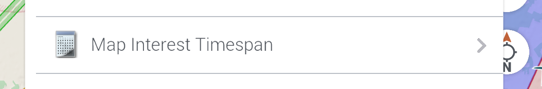
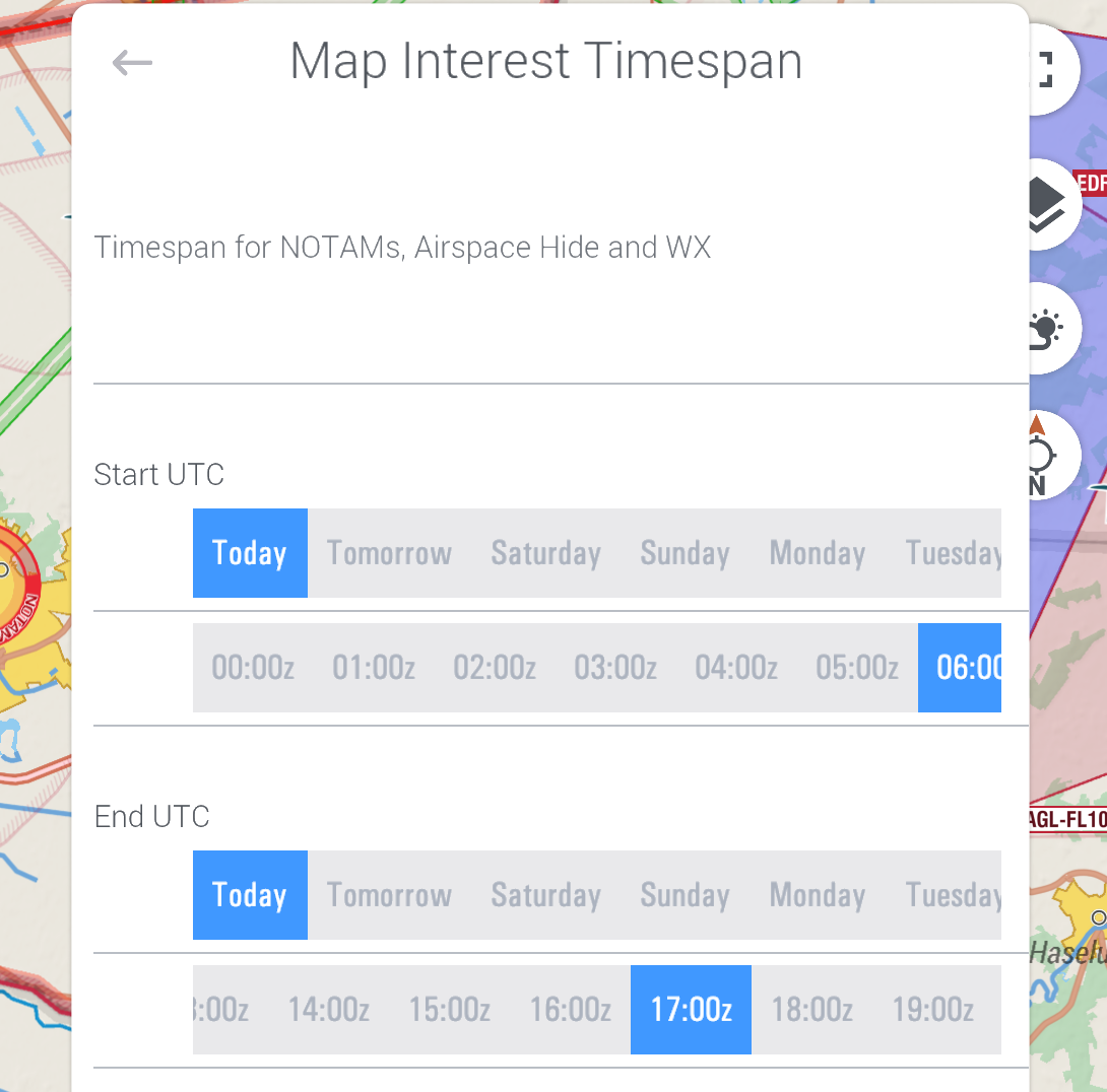
Without Route
When no route is loaded, set the date and timespan for showing dynamic airspaces via Map Layer menu → Map Interest Timespan.

How Does Dynamic Airspace Mapping Work?
EasyVFR 4 uses several parameters to determine if an airspace is active:
Time of day limitations like daytime or nighttime as specified in the nation's AIP
Day of week limitations like weekdays only or specific days of the week as specified in the nation's AIP
Month of year (seasonal) limitations as specified in the nation's AIP
NOTAMs that activate/deactivate airspaces
NOTAMs that create prohibited or restricted areas
NOTAMs about relevant activity areas
AUP (Airspace Use Plan)
Supplements to the nation's AIP
Parameters 1, 2, and 3 are self-explanatory, but let's explain a bit more about the others.
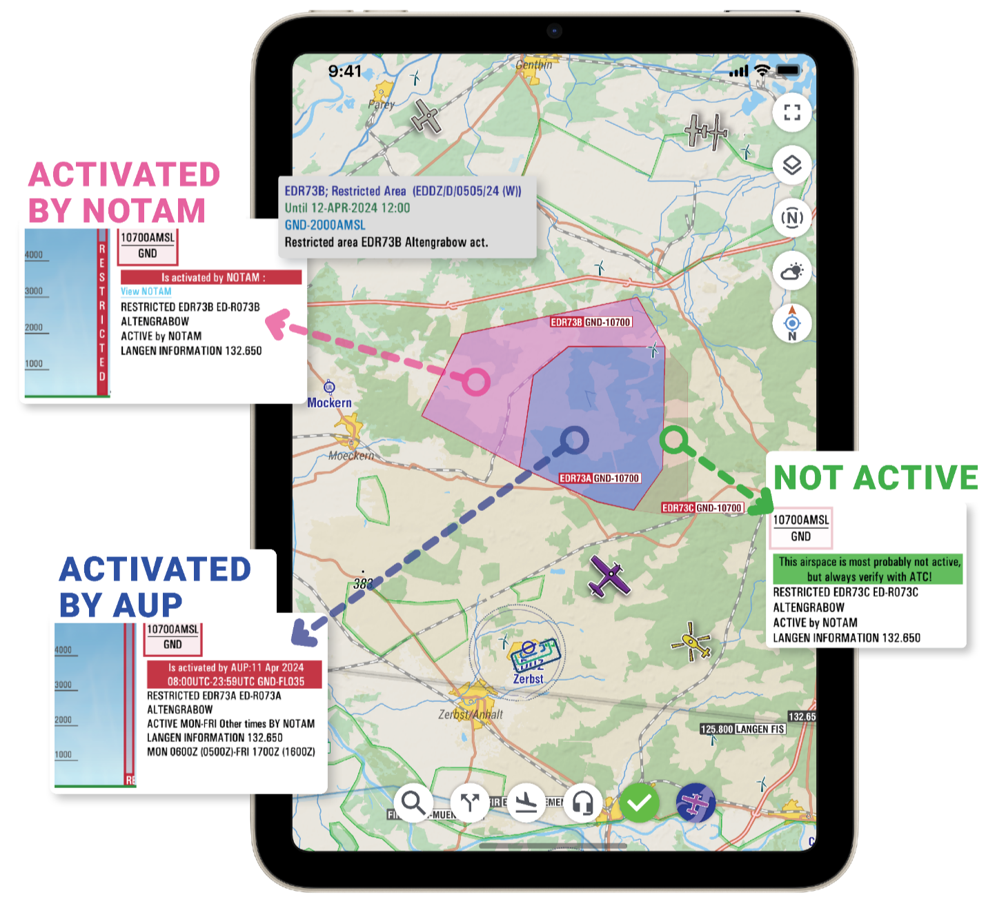
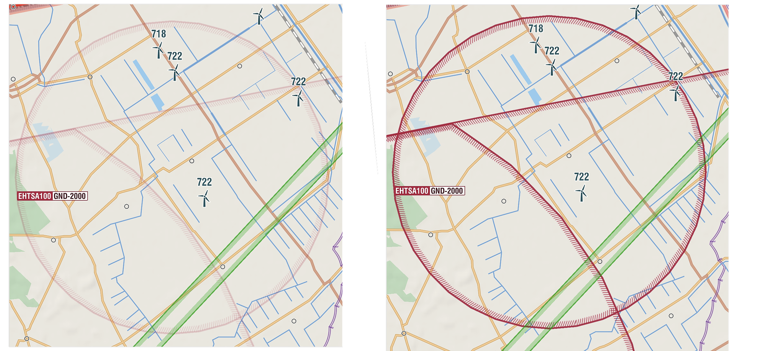
(De)Activated by NOTAM
For many airspaces like TRAs, restricted areas, and prohibited areas, the national AIP states that a NOTAM will be issued when they become active. For example, the EH-TRA and EH-TSA airspaces on the paper map snippet are all airspaces for which the AIP has defined that a NOTAM will be issued when they are activated. Because EasyVFR 4 is connected to the official NOTAM feed, it can perform this NOTAM check. In this case, no NOTAMs were found for these EH-TRA and EH-TSA airspaces, so they are not active for the setup Map Interest Timespan. To depict this inactive state, EasyVFR draws these airspaces using a faint coloring:
Images: Inactive vs. Active Airspace
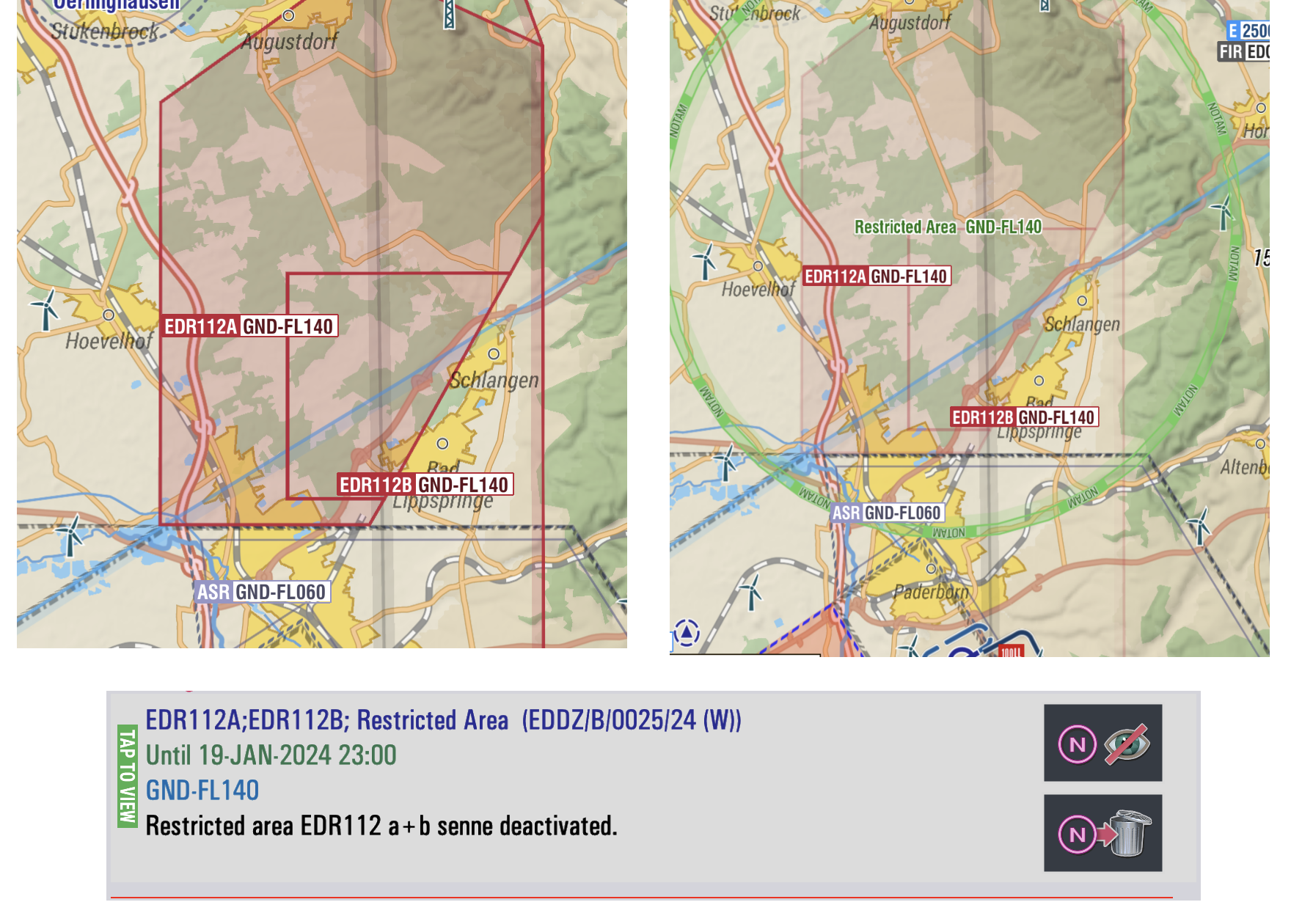
Although not common, sometimes a NOTAM explicitly deactivates an airspace. EasyVFR will depict these NOTAMs too by using a green NOTAM depiction for the Q-Line and, of course, displays the deactivated airspace as not active.
Images: Dynamic Airspace Off / Dynamic Airspace On / NOTAM Text
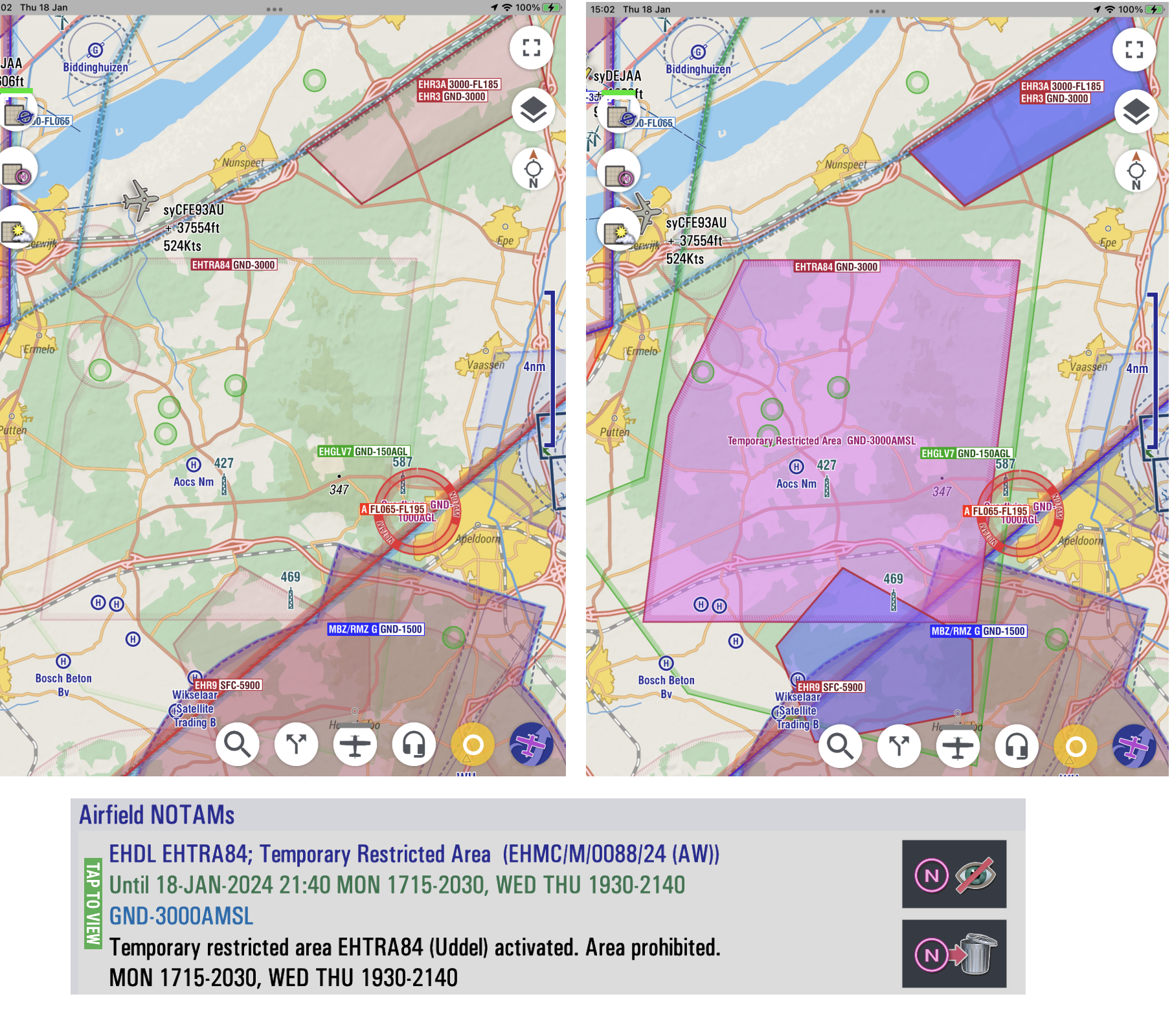
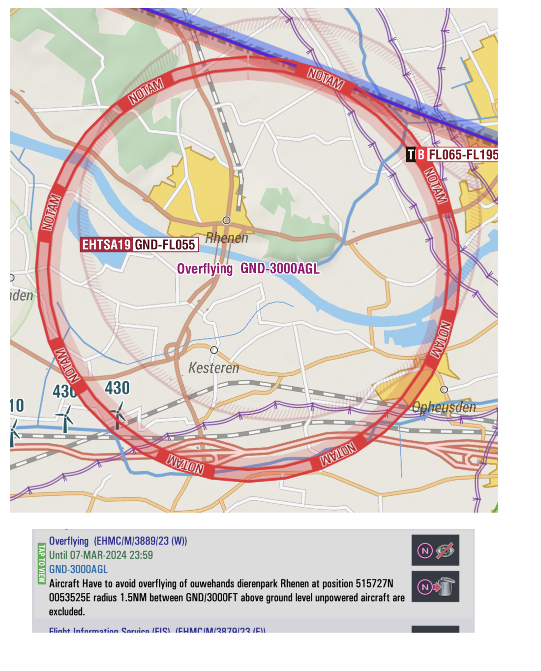
As a pilot, it's often convenient to know if an often inactive airspace suddenly becomes active. To facilitate this, EasyVFR uses a pink interior filling for any airspace currently activated by NOTAM.
Images: EHTRA84 Not Active / EHTRA84 Activated by NOTAM / The Activating NOTAM
Prohibited or Restricted Area Published by NOTAM
Prohibited and restricted areas are not always published using predefined airspaces listed in the AIP. Often, a NOTAM describes an area using coordinates, and EasyVFR 4 will always plot such airspaces on the map using a red "NOTAM" bannered outline.
Images: Graphical vs. Textual Depiction of a NOTAM Created Restricted Area
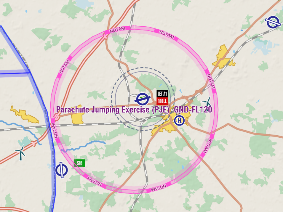
Graphical NOTAM - Mapping Relevant Activity Areas
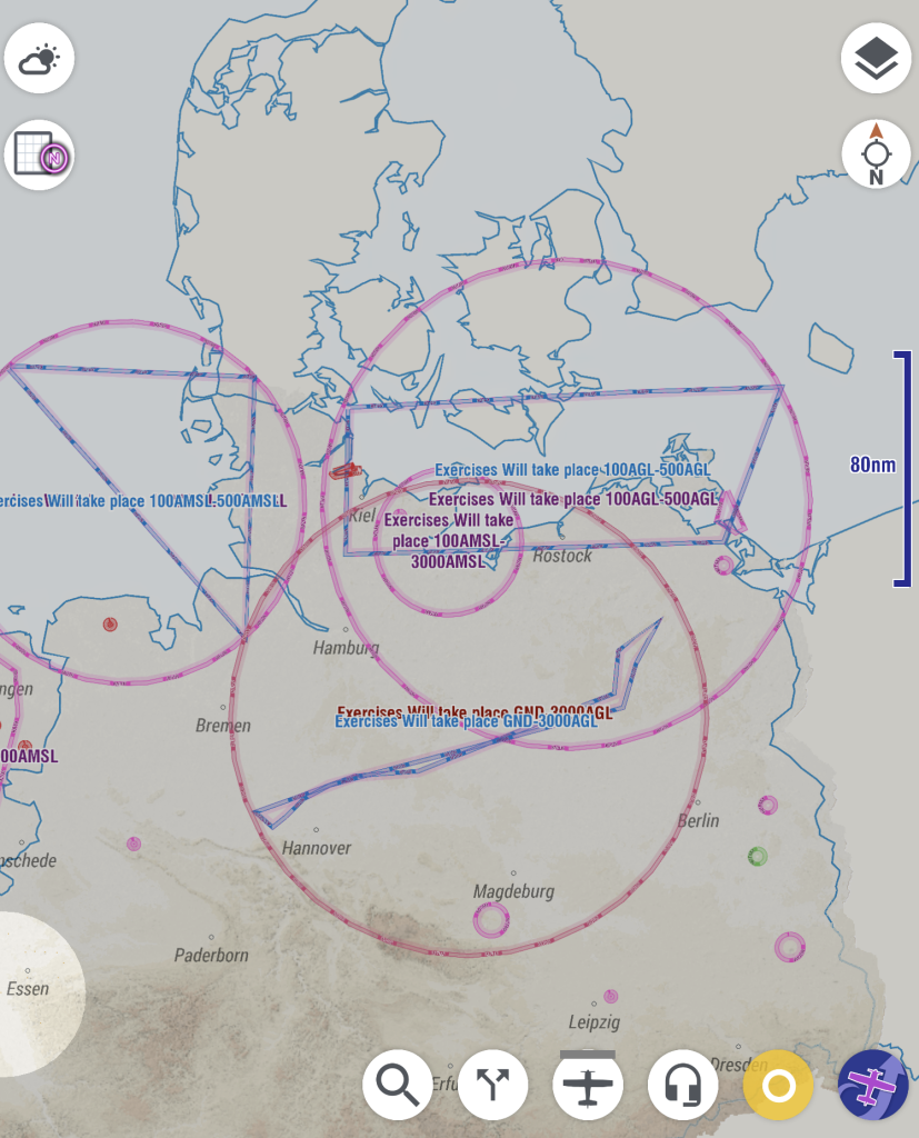
NOTAMs can also be issued to alert pilots about potential relevant activities, such as low-level military flight training, aerobatics, or glider flying. A pilot is allowed to fly in those areas, but it's good to know these activities can take place.
The shape of these NOTAM areas is often not a simple circle with a center and radius; various techniques are used to reliably map and draw polygons on the map. There are three ways this information is shared:
Q-Line Circle: In the NOTAM Q-line, a point + radius definition is given by the NOTAM issuer to ensure coverage of at least all the involved area.
Metadata: A list of coordinates shared in the NOTAMs metadata, which is not very often used.
Free Text: In the NOTAM text itself as free text, which is the same text pilots are obligated to read. In free text, the issuer can describe the area in all sorts of coordinate formats or even using words like "follows the river/along the border," etc.
The first variant is straightforward and is what most NOTAM plotters use. The second is also used by other apps, but unfortunately not often used by NOTAM issuers. Making sense of the third variant, where the shape is defined in free text, is where EasyVFR excels.
1 - Only in Q-Line Defined Circle
Image: Circular NOTAM
2 - With Correctly Defined Polygon in NOTAM Metadata
EasyVFR 4's NOTAM processing system analyzes the NOTAMs metadata, and when it is 100% sure about the described area, EasyVFR will mark this area using a pink "NOTAM"-bannered outline.
Images: Graphical NOTAM / NOTAM Text
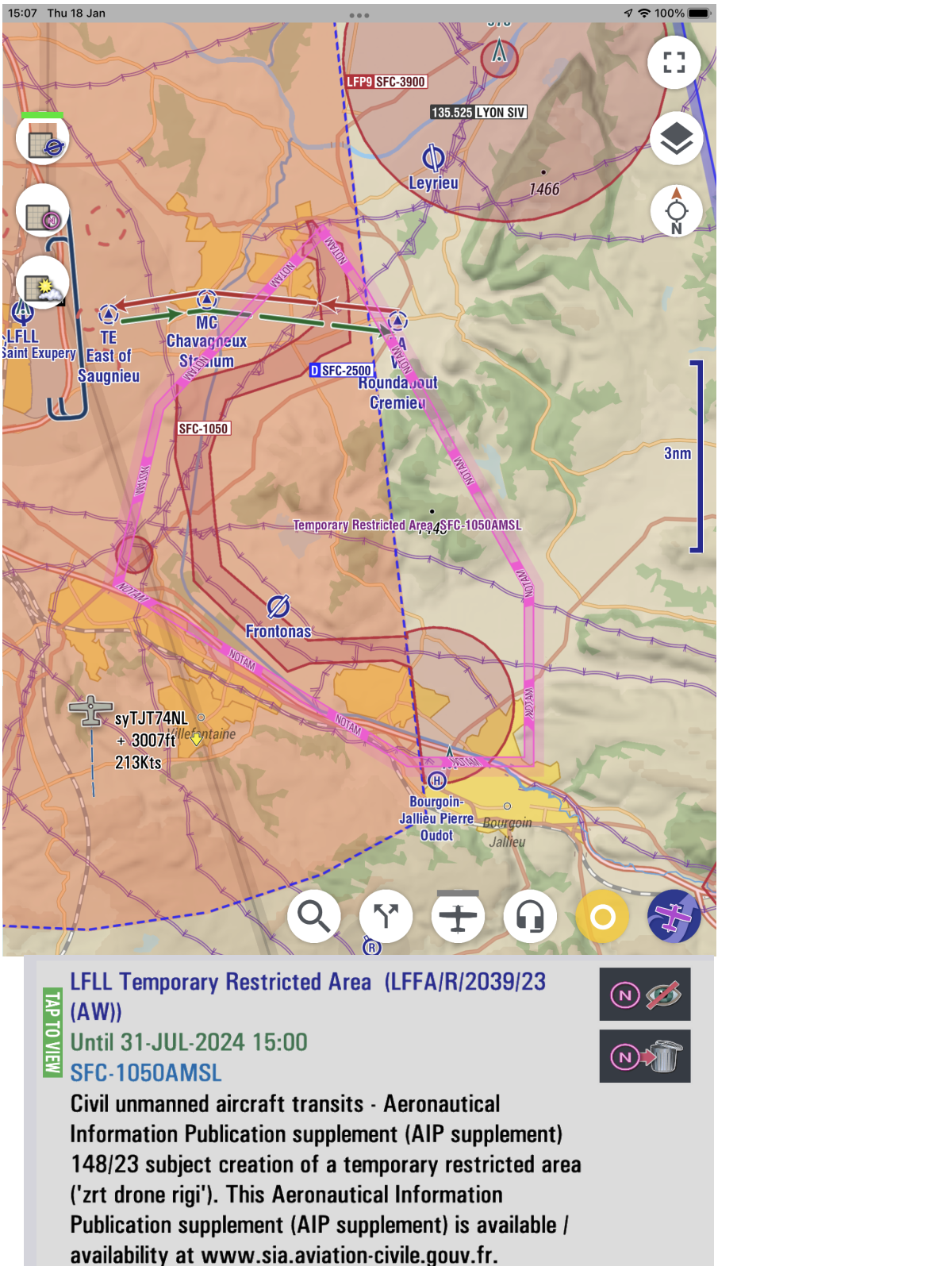
3 - NOTAM Replotting Using Text Analyses
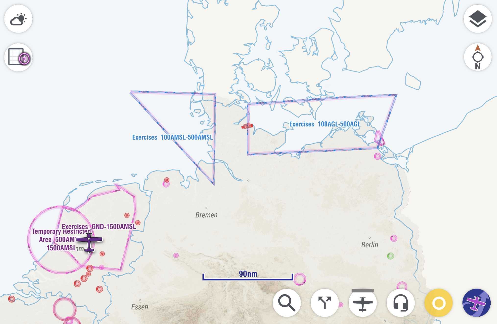
When there is an area described in the free text of a NOTAM, EasyVFR 4 will analyze this to draw the extracted area definition on the map. As a fail-safe, it will also draw the Q-line circle or use the metadata variant.
Image: Mapping Both NOTAM Definitions as Fallback
Optional - Hide Original NOTAM to Only Show the Replotted
Although the drawn area is not always 100% correct, it's good enough to understand where the activity is actually taking place. To declutter the map, EasyVFR 4 has a special feature offering to suppress the drawing of the circular Q-line outline. When viewing the map using the NOTAM Map Preset, a tap on the screen will bring up details about the NOTAMs that are valid for the tapped location.
Image: Same NOTAM Listed Twice - Replotted and Original
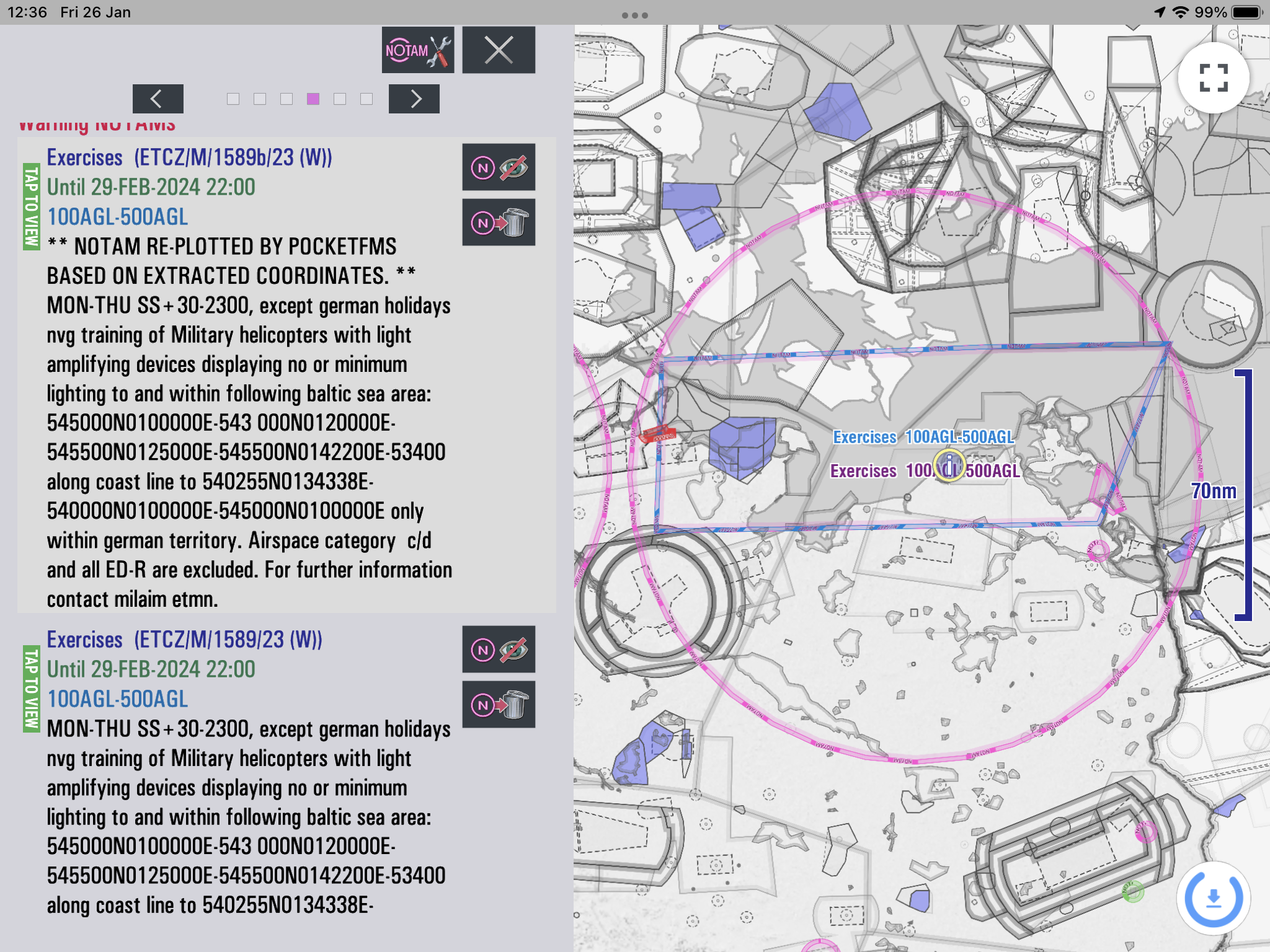
One NOTAM detail begins with "** NOTAM RE-PLOTTED BY POCKETFMS BASED ON EXTRACTED COORDINATES **; this is to differentiate this detail from the actual "official" version that is listed below that one. Note that both NOTAM Details refer to the same NOTAM id: ETCZ/M/1598/23, but the replotted one has a small "b" as a suffix to the NOTAM number. The replotted area is good enough to define the area, so we can now remove the original Q-Line version from the map by tapping on the Hide or Delete button.
Images: Same NOTAM Listed Twice / Hide the Original / Only Replotted NOTAM
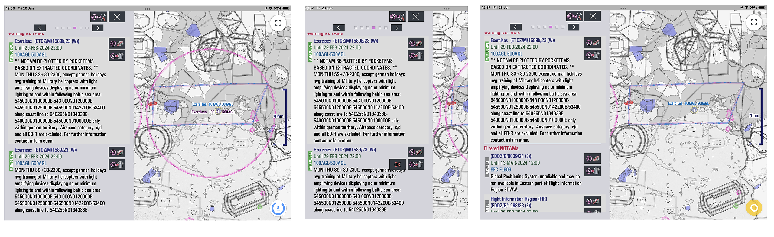
Now a clear, comprehensive overview of all important NOTAMs becomes available.
Image: Replotted NOTAMs with Hidden Original
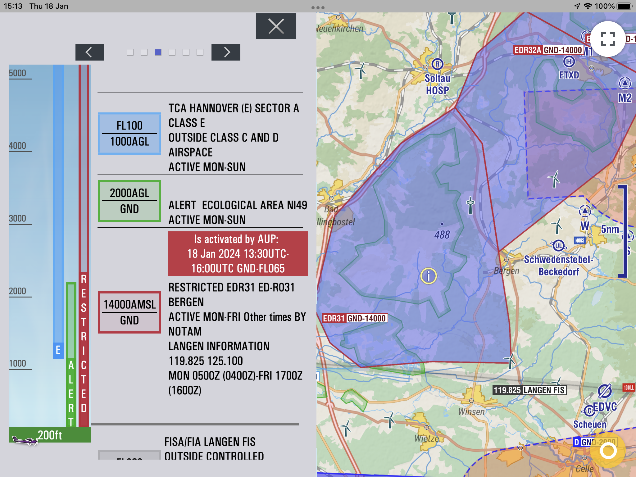
By Airspace Use Plan (AUP/UUP) Activated Airspaces
Many European countries use an Airspace Use Plan (AUP and UUP). The AUP is published daily and is valid for 24 hours, starting at 0600 UTC on the day of operation. Eurocontrol publishes Europe-wide EAUP. UUP are the updates published during the day and can only contain cancellations of in AUP reserved airspaces.
Because EasyVFR 4 knows which airspaces are always activated by AUP, it uses this publication to either mark an airspace as not active or active, just as done with NOTAM airspaces. Instead of the pink color used for NOTAM activated airspaces, EasyVFR 4 uses a purple color to indicate AUP activated airspaces:
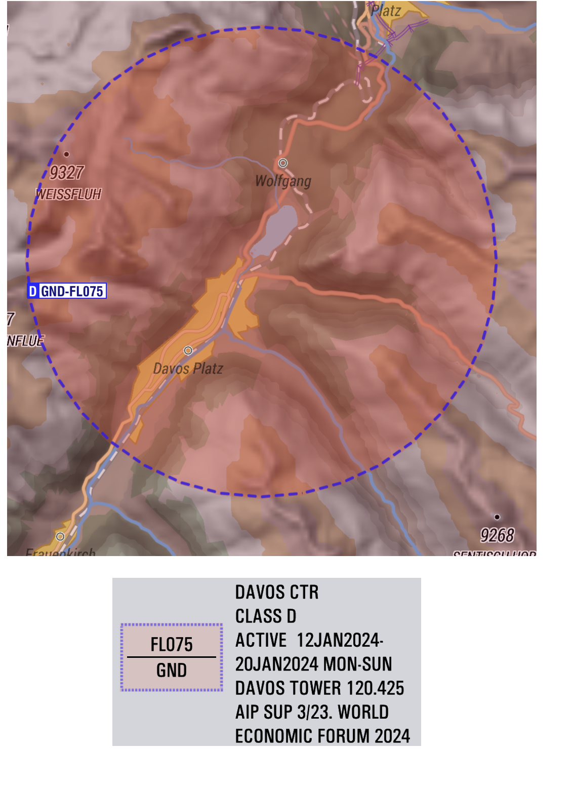
AIP Supplements
More and more countries are using AIP supplements to create temporary restricted areas for which there is no guarantee a NOTAM will actually be issued. These AIP supplements are being issued more frequently and require a continuous process to guarantee that these temporary areas are also shown on the map. The tricky bit is that these SUPs are not published following the AIP AIRAC cycles. They can be issued anytime, just like NOTAMs. EasyVFR 4 is one of the few digital maps that offer these.
Dynamic Airspace Mapping Limitations
Dynamic Airspace Mapping is only available for subscribers to our EasyVFR Live, Pro, and FFM tiers.
Sometimes a NOTAM specifies more than just a simple start and end date/time. For example, specific times for specific dates within a longer period. In these cases, EasyVFR will consider the airspace/NOTAM active for the entire period the NOTAM is defined for.
With every filter and hiding decision, EasyVFR 4 takes a "better safe than sorry" interpretation.
The system has been actively tested and used for a few years now by thousands of experienced pilots throughout Europe.