AeroData is professionally maintained and continuously updated and improved. Reports of omissions that are received by us are investigated and if necessary repaired on very short notice - usually the very same day, even within hours. The AeroData is constantly being rebuilt every 2 hours (24/7), including any corrections that may have been required.
AeroData is available for AF-3400s, AF-3500s, AF-4500s and the AF-5000 Series running Map Version 16 Software. Data will be exported via PocketFMS Desktop application. A Frequent Flyer Membership (FFM) license is required.
Installing PocketFMS
Read more on PocketFMS EFIS AeroData.
Download PocketFMS Desktop for your region.
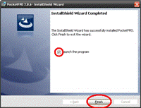
Open the installer and follow the prompts.
Uncheck the "Launch the program" and click "Finish".
PocketFMS Software Updates
After a fresh installation, you need to make sure you have the latest .dll file replaced. Download PocketFMS MV16 EV09
Extract and replace your current AdvancedFlightSystems.dll file normally located within C:\Program Files (x86)\PocketFMS\ directory.
Start PocketFMS desktop and sign in
Agree to the EULA Enter your email and registration number.
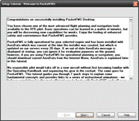
Take a moment to go through the tutorial. It will explain some useful information.
Setting PocketFMS Export Regions
From PocketFMS Manual - Selecting ARTCCs/FIRs.
The International Civil Aviation Organization (ICAO) has divided the global airspace into Regions, which are in turn subdivided into Flight Information Regions (FIRs). US users probably know these FIRs as Air Route Traffic Control Centers (ARTCCs). For example, the Netherlands airspace is situated in the European Region, and is divided in only one FIR, the Amsterdam FIR (ICAO code: EHAA). PocketFMS uses these FIR boundaries to determine which data to load and use. It is therefore important that you at least select one FIR you'll be flying in.
Click your part of the world below to find out which FIRs / ARTCCs you fly.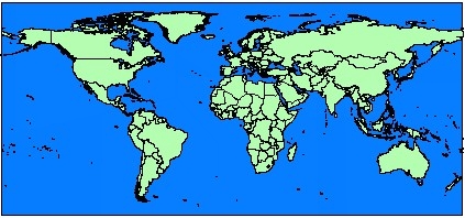
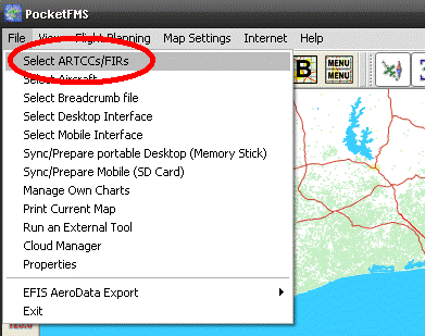
Next you will need to select which regions you will need in your map file. Select File -> Select ARTCCs/FIRs.
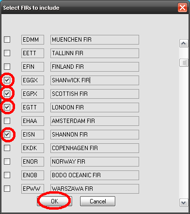
You will be presented a scrollable list (Fig. 2.), each line consisting of a tick box, an ICAO FIR identifier and the plain name of the FIR. By scrolling up and down you can browse the list, and place tick marks with every FIR you want to load data for. Remember that the more FIRs you select, the longer the AeroData will take to download, and the less memory will remain free on your Mobile Device.
For this example, we are going to create a map for Ireland, Scotland, and England the selecting "OK".
We are now prompted to refresh our AeroData, select "OK".
When File | Select ARTCCs/FIRs is selected and a FlightPlan is still open, PocketFMS will display a message that the FlightPlan must be closed first to prevent problems in case one or more elements from the active FlightPlan become deleted due to the corresponding FIR's removal. Loading a FlightPlan without all the required FIRs selected will result in PocketFMS removing the legs that are outside the available FIRs. After selecting the FIRs press OK.
Please note the following:
- If you have made changes to the FIR selection, you will need to download AeroData for the changes to become visible. Until that time, the existing AeroData set remains in effect. PocketFMS will remind you of this.
- If you select a FIR that you haven't ever selected before, it might also be necessary to download additional Map Data. However, if you have previously downloaded maps for a FIR, they will remain available if you unselect and later reselect that FIR.
- If you're using any other than the most recent version of PocketFMS, the available AeroData may not be compatible anymore. No AeroData is available for legacy versions.
- It's not always possible to have airspaces and objects that are positioned on or close near FIR boundaries assigned to the proper FIR automatically. To assure that all airspaces and objects in a FIR are shown, the adjacent FIRs should be selected as well.
Export AeroData PocketFMS
Every 28 days new AeroData will be available to download and export through the PocketFMS Desktop Application. The more FIRs selected the longer this process will take. If you have a new SD Card for your EFIS be sure to follow these instructions before proceeding: https://www.advancedflightsystems.com/advanced-storage.php
Select Internet -> AeroData -> Download AeroData.
Allow the map data to be updated.
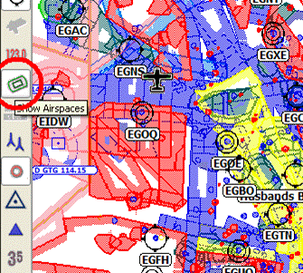
You should now be able to select Show Airspaces and see your mapping information.
Insert your SD card into your computer. Select File -> EFIS AeroData Export -> Advanced Flight Systems.
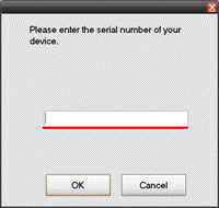
Enter the serial number from your Advanced Flight PFD.
If prompted say No to the Heliport prompt. Our software will already filters out heliports.
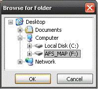
Select your AFS_MAP data card and select "OK".
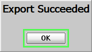
Your map file is now being generated. Once your export has succeeded select "OK".
At this point your map card has been loaded with the required Map file (AF2MAPFM.AFM) and an (Export Report.txt).
If this is your first time creating a map card you will need to copy the Support Files AF2VEC__.AFM and AF2TER__.AFM (instructions below) to your card.
Support Files
Along with the data that is generated by PocketFMS your EFIS will also need additional information to allow it to display Synthetic Vision.
Please select the region in which you will be flying from below.
Terrain and Vector Files (Updated 2011-02-15).
- Africa (Light Blue)
- Middle East (Yellow)
- South America (Red)
- Asia (Gray)
- North America (Green)
- United States
- Europe (White)
- Pacific Ocean (Orange)
New Card Setup
When you acquire a new SD card for use with PocketFMS map data please follow these instructions at the Advanced Flight System website to ensure your card is ready for use.


